Where to go to escape the winter? When thinking about Florida or Mexico, there came a thought why not tropical place? why not Central America? why not Costa Rica? And its one such place which doesn't require a visa application, phew!!! thanks Costa Rica. So as long as you have a valid USA/Canada/Schengen visa(tourist/business/work), they will issue a visa on arrival for 30 days/6 months(Japan), visit this website for more details.
Costa Rica is a place where everyone gets to do something, beach lovers? Hikers? bird watchers? Wild life photographers? Surfers? you name it, it has everything! It has pacific and caribbean beaches, coral reefs, swamp lands, volcanoes, hot springs, abundant wildlife, rain forests and cloud forests.
Flight tickets around December, which is usually the peak time are costly, especially after Christmas/New year. Anywhere between 300$ to 400$ is a very good price for a round trip ticket from East coast (USA) to Liberia/San Jose. You can either do a round trip to a single city (Liberia/San Jose) or arrive at Liberia and depart at San Jose or which ever way the ticket works out for you.
I did both, I was told not to drive and it would be pathetic to drive there!!! And its wrong. I came from a place where traffic and driving is crazy, beyond imagination, well mostly because of its population and this place is nothing compared to it. But I still booked taxi's for the first 4 days ( Liberia - Arenal - Monteverde - San Jose) and a rental car ( Enterprise rent a car) from San Jose for rest of the trip, which i can either pick it up or cancel based on seeing the roads in Costa Rica. But trust me it was absolutely great driving there. Glad i booked one and sad that i didn't for the first four days. The roads were super awesome, dotted lines/lanes to pass, stop/yield(ceida)signs, no potholes, no one was driving rash, everyone is courteous and respectful. The only thing i was told by localites was not to leave anything visible in the car, don't invite the thief by yourself!
Manual/Automatic drive/Insurance:
If you are not comfortable driving manual/stick shift, don't!!! pay extra bucks and get automatic drive. There will be some slopes and hills where you should be really quick at it. Ask yourself, can you stop on a slope with a car behind you and move quickly without going backwards?? Then coming to a question if you need 4 wheel drive or not? Some places requires 4WD, like Rio Celeste/Tenorio Volcano needs it, although we managed to do in 2WD with some struggles. So i highly recommend 4WD for peace of mind. We rented a 2WD swift dzire - manual drive. It really did a great job- no complains!!! If you are picking up at one airport and dropping at a different one then be prepared to pay a drop off charge of 35-50$. On the topic car insurance, I just had to take the liability coverage (~5$/day) from the rental company as its not covered by the Credit card company ( Chase sapphire preferred was what I used). But I am covered (collision Ins.) by Chase if anything happens to my car damage/theft/road side assistance and in order have this coverage in effect you need to decline collision insurance provided by the rental company and charge the entire rental cost to your card, bingo!
My trip was 9 days & 9 nights - Round trip to Liberia (LIR)
We started off from Liberia, then to Arenal/La fortuna - Cano Negro wildlife refuge- Monteverde- San Jose, then from San Jose couple of day trips to Manuel Antonio & Poas volcano -Doka coffee estate-La paz gardens, then drive up north east to La selva Biological station (OTS)- Rio Celeste/Tenorio Volcano National Park- Playa Hermosa beach (via Liberia)- Playa Ocotal/panama and near by beaches- then back to Liberia airport.
Day 1: Arenal Volcano National Park
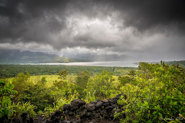
Shuttle arrived at 6:30am (by Anywherecostarica) to get us dropped at Arenal Backpackers hostel. Its a 5 star hostel :). The hostel was great, with a swimming pool and an amazing cafe inside (loved their burrito and fresh fruits). We stayed here for 2 nights and you get to meet a lot of people around the world. The drive from Liberia to Arenal was 2.5 hrs, not bad at all. This was when we realized we should have rented a car!!! After getting freshened up, we went to Arenal Volcano National park for a hike (10$ entree fee), it took us about 3 hrs to complete the yellow trail (5 km) which was through the rain forest and cooled molten lava areas(1968 eruption).
p.s: Take poncho, umbrella, water proof Jacket and rain boots!!! I had a poncho even for my camera.
 |
| Arenal Lake |
 |
| Behind the clouds is the Arenal Volcano |
 |
| My fellow travelers |
 |
| Cooled lava from 1968 eruption. |
 |
| Almost end of the trail. |
How about a relaxing Hot springs after a tiring hike!!! :), yea we went to the public free hot springs (next to tabacon resort), which is a natural river and quite a few people was sitting comfortably on the river. I heard from a fellow traveler that Baldi hot springs are nice enough and they charge 45$ per person for hot springs with buffet dinner (Baldi is like pumped water from the river, since the property is not as such located next to the river unlike Tabacon which is why Tabacon is costly ~75$). We tried Le chorizo restaurant and the organic chocolate store near by, they both were fabulous.
 |
| Top to bottom: Chicken platter, Squash soup, sour sap juice and veggie platter with fried banana. |
 |
| Cardamom/Elaichi Chocolate |
DAY 2: CANO NEGRO WILDLIFE
Right next to the border of Nicaragua is a boat accessible wildlife rich forest. We took the tours from anywherecostarica, they picked us up from the hostel at 7:30am, boat ride/wild life watching/refreshments, lunch and dropped us back to the hostel at 3:30pm.
While checking out La Fortuna downtown, we met this interesting guy few blocks from Arenal Backpackers hostel, he is from Philly and the agent of Eco hostel. He promised us with the best night tour in Arenal from a guy called Giovanni. And the photos below are the proof of them! we simply enjoyed it, not only night tour, Giovanni even took us the next day early morning for watching toucans and other birds. Thanks to both Philly guy and Giovanni for such an amazing experience.
 |
| Blue Jean Poison Dart Frog |
 |
| Glass Frog |
 |
| Jesus Christ Lizard |
DAY 3: Cerro Chato Hike/La fortuna water falls
After taking non stop photographs of birds eating banana & papaya, we had a strong coffee in Giovanni's tour. Then we took a taxi (the pain of not having your own car!) to cerro chato passing the la fortuna falls, its like 10 min drive from Arenal Backpackers hostel. Leaving all camera gears at the reception of the Cerro Chato lodge, we paid 12$ for gaining access to this beautiful and strenuous hike. The rain forest was splendid, though we were not lucky enough to see the crater lake since it was cloud covered. The hike took us around 5 hrs, but was helping a guy who broke his wrist while running downhill, so probably time it as approx. 4 hrs round trip.
Time to pack up for next town! we took a taxi at 2:30 pm (shuttle - water taxi - shuttle) to Monteverde (cloud forest region). Which can be booked locally through Eco hostel guy (~15$/person). Desafio/anywherecostarica charges approx 18-25$/person. The night stay at monteverde is 2 min walk from downtown and booked through Airbnb (Don Taco Hotel).
Days 4-9 will be continued in next post!!!


